
Recent satellite images analyzed by Al Jazeera’s open-source unit have revealed accelerated construction activity in Rafah, southern Gaza, including the establishment of an Israeli military site on the ruins of the Swedish Village near the coastline, close to the Egypt-Gaza border, alongside the construction of an earth barrier stretching horizontally across southern Gaza for more than 2.5 kilometers.
A chronological analysis of the images shows that work on the coastal site was first detected on June 2, while construction of the earth barrier began in early July and expanded significantly by mid-month.
On the Ruins of the Swedish Village
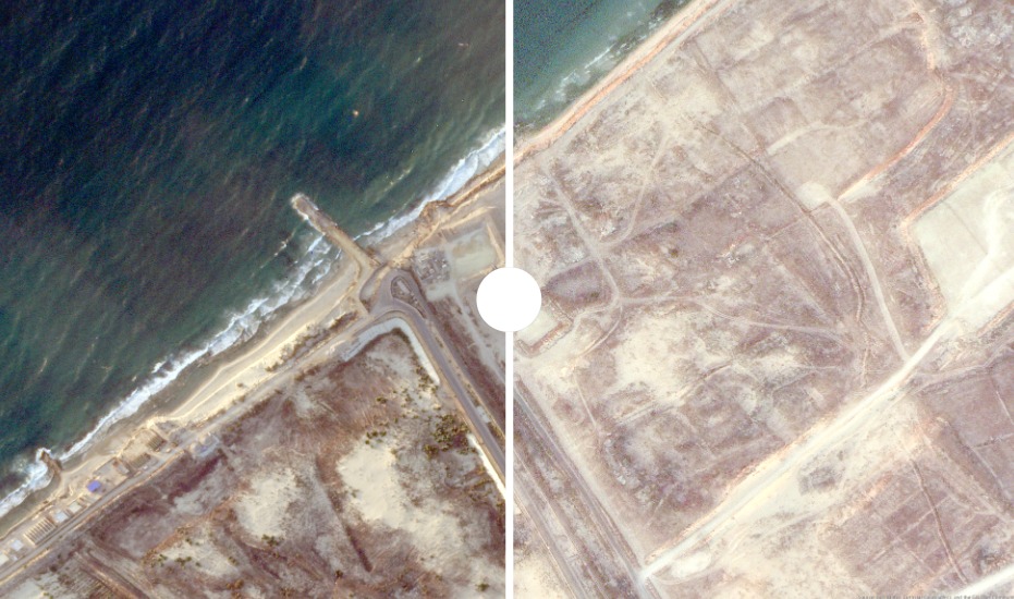
An image captured on July 15 shows that the Israeli military established a military site on the ruins of the “Swedish Village” located along the Rafah coastline.
The village previously contained a residential community before it was destroyed during the war. Construction work at the site included demolitions, land clearing, and debris removal. Measurements from satellite imagery indicate that the newly built military site is approximately 110 meters long and 85 meters wide.
Rapidly Expanding Earth Barrier
At another location in southern Gaza, images from July 15 show a winding earth barrier cutting through open areas in Al-Mawasi, Rafah.
The first signs of construction appeared in early July. By mid-month, the barrier had extended to approximately 2,650 meters, based on measurements of its winding path in satellite images. The work is believed to still be ongoing, as some sections at the end of the barrier appeared incomplete.
The earth barrier appears as a light-colored strip surrounded by signs of excavation and heavy machinery activity. It was built outside the boundaries of the “Yellow Line,” which separates areas under Israeli control from Al-Mawasi, where large numbers of displaced Palestinians are sheltering.
The analysis showed that the barrier’s route crosses areas marked by the “Orange Line,” passing through open and agricultural land south of Al-Mawasi near displaced communities.
Rafah Under Major Changes
Satellite images indicate that recent developments in Rafah are strengthening the Israeli military presence in the city and potentially extending its presence for a longer period.
The restructuring of the Israeli military site and the construction of an earth barrier several hundred meters away suggest that Israeli forces are fortifying the area compared with earlier stages of the war.
The developments also carry additional significance due to their sensitive geographic location, as they are situated near the border with Egypt and adjacent to Al-Mawasi, an area hosting large numbers of displaced Palestinians.
No comments yet. Be the first to share your thoughts.